Why Mobile GIS is Critical to Preventing Gas Explosions
Why Mobile GIS is Critical to Preventing Gas Explosions
- Last Updated: December 2, 2024
Unearth
- Last Updated: December 2, 2024

This article is part 1 of a 2-part series on Mobile GIS and cross bores.
Cross bores occur when a natural gas line is accidentally drilled through existing underground infrastructure - like a sewer pipe. They're a big problem for utilities and a risk to public health because of their role in natural gas explosions.
However, new mapping technology - Mobile GIS - can help reduce the risks of cross bores by decreasing costs and increasing speed in utility integrity management.
'The utility industry needs a standardized, simple system of record that maintains a single source of truth from the beginning to the end of the process.' -Unearth
The Cross Bore Problem in the US
Estimates place the number of cross bores in the United States at up to 1 million.
The number of destructive incidents is more difficult to pin down, but between 2000 and 2010 there were 18 cross bore-related explosions, averaging approximately two incidents per year. Steps are now being taken to prevent new cross bores.
However, the only way to prevent deaths from existing ones is to manually inspect every length of sewer pipe in the country. The Cross Bore Detection and Mitigation was created to accomplish this immense task.
Utility companies own the risks related to cross bore incidents and thus the responsibility for preventing them. Knowledge sharing occurs industry-wide with the common goal of helping everyone develop the best cross bore program possible.
However, there is a notable lack of standardization in the tools and methodologies implemented to accomplish find and resolve cross bores.

Image Source: Unearth
In the Common Ground Alliance’s 2018 Technology Report: Technology Advancements & Gaps in Underground Safety, the organization identifies thirteen areas related to mapping and GIS that need technological solutions:
- Accurate mapping of underground facilities
- Mapping near misses - collecting and enabling the use of this data
- Mapping damage locations
- Enabling data sharing
- Identifying facilities currently not mapped, recorded, or known
- Making the GPS mapping technology usable by construction crews
- Integrating GPS mapping and GIS in real time and workflow
- Using routine maintenance opportunities to GPS-record assets
- Creating “open” GIS systems/better sharing of the data
- Mapping assets through mainline inspections and associating location with video
- Providing better GPS signal strength in urban canyons and under tree cover*
- Providing software analysis for quality feedback about GPS coordinate collection
- Developing standards for GPS data quality
This blog proposes the implementation of Mobile GIS to address 12 of the 13 issues above - helping to save lives by creating a faster, more cost-effective legacy cross bore process.
Goals and Challenges of Cross Bore Programs
A standard legacy cross bore program, one that focuses on finding and repairing existing cross bores, contains the following parts:
- Risk assessment: Determine the risk of a cross bore incident and prioritize areas for inspection by analyzing parcel and plat data.
Risk assessment involves sorting, organizing, and analyzing massive amounts of data related to a broad physical location. The results must then be organized in a way that is easily accessible and understandable for the next step. The heavy amount of data-related work is time-consuming and resource intensive. - Inspection Packet Assignment: Individual inspection teams must take their assignment, run a sewer scope for each parcel, and precisely record the results.
Each field team and each contracting company must develop their own process of recording data according to the materials provided to them by the utility company. These methods often rely on a mixture of PDF files and paper and require information to be copied by hand multiple times. The lack of standardization and digitization introduces a wide opportunity for error. - Parcel Inspection: The contractor must take the inspection packet assignment from the utility and effectively distribute the work to their field teams while accurately tracking the progress.
Many potential issues arise in this step, as it’s the first instance where instructions are passed through multiple people. The challenge for the utility company is making sure their packet assignment is easily understood, while the challenge for contractors is making sure they properly understand the assignment and can effectively optimize their work and inspection routes. If wires are crossed here, inspections won’t happen properly and work will need to be redone. - Data Capture: Effectively transfer inspection data from the field to the utility company.
Transferring this large quantity of data results in a number of pain points. Video evidence is often sent in DVD format, which makes it highly challenging to review quickly. Map data must also be compiled and sent off in a way that coordinates with the video data. The combination of physical media and digital documents leads to a slow and disorganized data transfer process that can severely delay schedules and result in lost data. - QA/QC Review: It’s the responsibility of the utility company to verify the data sent to them by their contractors, ensuring it meets accuracy and standards guidelines. The QA/QC review process exists as a failsafe step to make sure that no cross bore goes unnoticed. If the utility company finds a problem, the information must be sent back to the contractor to be reviewed and re-inspected.
This step can be a significant time drain. With no standardized methods of data collection and no organized reporting, error rates can be quite high. Higher error rates mean significant delays as reports must be sent back and forth for multiple inspections. - Cataloging: Once the data has been verified, it must be transferred into the utilities' preferred format of record, distributed to the appropriate teams, and then stored for future reference.
Cataloging introduces more room for error, as data must be transcribed once again. It also creates another bottleneck in the cross bore process because it’s an expensive, manual effort limited by the number of people devoted to the process.
In laying out the steps and challenges of a legacy cross bore program, a clear theme emerges. The utility industry needs a standardized, simple system of record that maintains a single source of truth from the beginning to the end of the process. Only one category of software comes close to addressing these needs: Geographic Information Systems (GIS).
The Role of GIS in Legacy Cross Bore Programs
GIS refers to a broad group of data management systems that organize information by location - two well-known examples are Google Earth and ESRI.
GIS technology typically features a set of powerful tools for a variety of advanced data applications. Unfortunately, the complexity inherent to this type of software typically limits its accessibility to only professionally trained personnel.
For legacy cross bore work, the basic function of GIS software is to enable a utility to properly document inspected sewer lines on a map of their territory. In an ideal world, GIS software would be the foundation of a legacy cross bore program, from identifying and assigning work, all the way to cataloging inspected parcels.
Unfortunately, most GIS software is too cumbersome to be used efficiently by each individual involved in the cross bore mitigation and detection process. So, instead of becoming an essential tool for accomplishing work quickly and accurately, GIS becomes an inconvenient requirement of the data storage process.
If utility companies are ever going to effectively find and resolve every cross bore instance across the millions of miles of sewer infrastructure in the United States, they’ll need to streamline the use of GIS technology.
The industry must go beyond the current capabilities of modern Desktop GIS software, and work to create a map-based workflow that allows flawless communication and data transfer between the office and the field.
Going Beyond Desktop GIS: An End-To-End Approach to Legacy Cross Bores
The missing piece of modern GIS is its inability to be used by everyone involved in the cross bore detection and mitigation process.
This roadblock exists for a number of reasons:
- Data structures in GIS are not optimized for mobile devices or mobile networks.
- GIS requires expensive and powerful local hardware to run.
- The user experience of GIS software is complex, requiring years of training to master.
- Licensing structures are cost-prohibitive and restrictive, particularly when it comes to field teams.
These are the weaknesses of desktop GIS - powerful, yet complex technology installed on a computer, which doesn’t translate well to the field.
To go beyond GIS, the utility industry needs to implement a map-based system that doesn’t just store geospatial data, but also optimizes the process of cross bore detection and mitigation itself. In other words, utilities need Mobile GIS.
Effective Mobile GIS provides:
- Mobile-first design with data structures created for delivery over mobile networks.
- Cloud-based architecture that eliminates the need for powerful local hardware.
- A simple user experience that lets anyone pick it up and use it instantly.
- An adaptive license structure that’s flexible enough to meet the needs of scaling with field teams.
- A feature set that is still robust and powerful enough to meet the enormous data requirements of cross bore mitigation and detection.
With these pieces in place, a legacy cross bore program could be simplified and streamlined into a few steps that all take place in a single system:
- Upload or select the area that needs to be inspected.
- Assign the area to a designated field team.
- The field team marks their inspection directly into the system from the field.
- Maps and all associated data are instantly available for review by the utility.
- Once reviewed, the process is finished. There’s no need to transfer to another system of record.
If the industry can agree upon a standardized system and process, it can work together to help cross bore detection and mitigation evolve to be even faster and more streamlined.
Why Invest the Time and Effort to Procure Mobile GIS?
Ultimately, legacy cross bore programs are about saving lives.
With estimates of cross bores occurring at a rate of .4 for every mile of pipeline, and with 2.5 million miles of pipeline in the United States, this problem needs to be tackled as swiftly as possible.
In a good year, using current standards, a utility company can potentially clear around 35,000 addresses. Extrapolated out, that means clearing a large territory of 5 million addresses would take almost 150 years!
The hard truth is that with the current process, it will be impossible to ever fully complete a cross bore program in an acceptable time frame. With cross bore incidents occurring at a rate of about 2 per year, that’s a significant number of lives at risk.
If legacy cross bores are ever to become a thing of the past, and the risk of injury and death eliminated, the industry has to figure out how to make the process faster and cheaper.
A new method of GIS is the mission-critical task to accomplish these objectives; it offers the most opportunity to advance the goals from both a short- and long-term perspective.
Short-Term Benefits
End-to-end inspection speed can be significantly increased by simplifying time-consuming tasks and eliminating redundant steps in the assignment, inspection, and review processes.
As speed increases, the cost to inspect a parcel comes down, allowing teams to inspect a broader area for the same amount of budget. Additionally, as the number of systems involved declines, the budget spent to maintain them can be redirected toward other expenses, such as assigning more inspection packets.
Long-Term Benefits
The long term is where moving beyond Desktop GIS gets really exciting. Once inspection data begins to accumulate in a single system, the possibilities of what you can do with that data increase exponentially.
The most exciting prospects involve the potential for predictive analysis. With enough inspection data, utilities can begin to automatically identify areas with a high risk of cross bores, prioritize them based on their internal criteria, and then create a predictive schedule for when their entire service area will be free of legacy cross bores.
Modernizing the GIS standards of legacy cross bore programs is the essential first step in eliminating latent cross bores nationwide. Without a solid foundation, progress will continue to be slow and costly, making it virtually impossible to get rid of this threat.
The Most Comprehensive IoT Newsletter for Enterprises
Showcasing the highest-quality content, resources, news, and insights from the world of the Internet of Things. Subscribe to remain informed and up-to-date.
New Podcast Episode

IoT Is Finally Delivering
Related Articles


Related Solutions

Automated Rental Management
Track utility usage, detect outages, and gain real-time insights to prevent overpayments and improve cost control.
Track utility usage, detect outages, and gain real-time insights to prevent overpayments and improve cost control.
Prylada
Prylada

Power Plant Safety for Operators
Deploy instant, AI-powered monitoring across power generation facilities with a portable, plug-and-play solution.
Deploy instant, AI-powered monitoring across power generation facilities with a portable, plug-and-play solution.
Iveda
Iveda
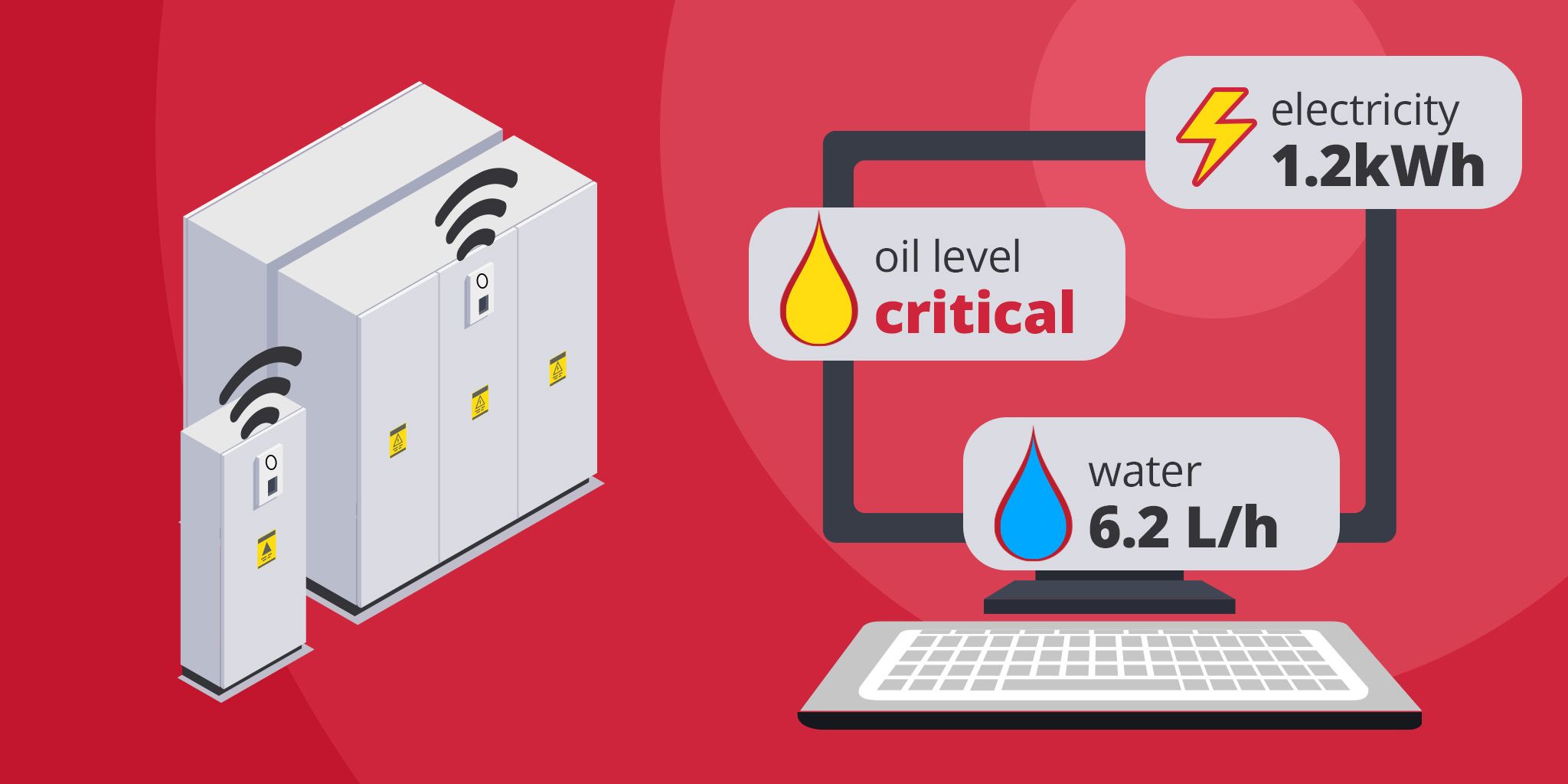
Energy Metering for Utilities
Unified metering for electricity, water, oil, and gas to reduce costs, improve efficiency, and support ESG reporting.
Unified metering for electricity, water, oil, and gas to reduce costs, improve efficiency, and support ESG reporting.
akenza
akenza
Related Solutions
Buildings & Facilities
Automated Rental Management
Track utility usage, detect outages, and gain real-time insights to prevent overpayments and improve cost control.
Prylada
Utilities
Power Plant Safety for Operators
Deploy instant, AI-powered monitoring across power generation facilities with a portable, plug-and-play solution.
Iveda
Utilities
Energy Metering for Utilities
Unified metering for electricity, water, oil, and gas to reduce costs, improve efficiency, and support ESG reporting.
akenza