Designing and Prototyping for GPS-Based Outdoor Asset Tracking Solutions
Designing and Prototyping for GPS-Based Outdoor Asset Tracking Solutions
- Last Updated: December 2, 2024
Leverege
- Last Updated: December 2, 2024

IoT and Design
As the Internet of Things (IoT) is expanding in accessibility and decreasing in cost per solution, the industry is seeing an influx of requests for outdoor asset tracking Applications. If you can think of an industry, there’s probably an asset tracking Applications. Healthcare? Tracking ambulance fleets. Cold chain? Tracking shipments through delivery. Education? Tracking university shuttle buses or maintenance carts.
The majority of outdoor asset tracking projects rely on GPS to transmit asset locations. GPS already exists everywhere in consumer IoT. Applications such as Uber and Find My Friends use GPS to track your smartphone’s exact geolocation. There are trade-offs to using GPS for asset tracking applications, but it’s the most ubiquitous type of location technology.
Product designers in IoT must also be cognizant of the difficulties in designing for industries and users that are not always tech-forward.
With more companies developing outdoor asset tracking platforms, we can see the beginnings of user experience (UX) best practices forming for product designers in IoT. While designers can pull best practices from other solutions that involve mapping, they often don’t cover the complexities that IoT pulls into the equation. Take Google Maps, for example–there's no question that it's a fantastic mobile and web application. Still, it doesn’t track moving assets, nor do locations have physical sensors reporting their whereabouts.
Another piece we must take into consideration is the user base. Often, the most impactful IoT solutions are in traditional industries, such as manufacturing and automotive. Product designers in IoT must also be cognizant of the difficulties in designing for industries and users that are not always tech-forward. Features should always be discoverable, but common UX practices may fall flat for audiences that don't use many modern platforms.
Outdoor Asset Tracking
Product designers are not unfamiliar with asking questions. It is part and parcel of the job. If product designers are not asking questions to understand user needs and goals, they aren't doing their job.
Specifically for outdoor asset tracking applications, there are a few key user experience questions designers should ask to assess how the solution should be designed. It’s not enough to throw icons onto a map. This list of questions does not wholly encompass everything that should be asked during the discovery phase of a project but rather are key ones I’ve distilled from experience after working on numerous outdoor asset tracking applications.
For Web, Desktop, or Mobile Outdoor Asset Tracking Solutions, One of the First Questions to Ask Is: Does This Application Need a Map?
Nearly every tracking Applications requires the use of a map, whether it’s a primary feature or an “only if needed” feature. Using Find My application by Apple as an example, we can break down where maps are and aren't as important. The only time a user needs the Find My map is if they’ve lost or misplaced their device in a different location from where they currently are. Perhaps their phone was stolen. The user could potentially track down the phone using the map on the application. If the user misplaced a device in their own home, the map isn’t useful as the location isn’t accurate to rooms, making the “Play Sound” feature the most important.
When in doubt, a designer should include a map, as there is usually some Applications within the platform that warrants a location visualization.
The Next Question Should Be: Does the Map Need Zones to Better Reflect Locations for a User?
To illustrate this question's importance, we turn to a large parking lot, such as at an airport, for example. When a driver parks their car in a large lot, they usually look to a posted sign for the zone or aisle name they parked in. It's also common to search for the parking space number, if available, so they can find the exact location where they parked their car at the end of their trip. The driver knows their car is parked in the Purple zone in space 302, rather than vaguely remembering that they parked near the northwest corner of the lot in space 302.
From this example, we can extrapolate how in some outdoor asset tracking applications, these zones allow a user to pinpoint, rather than an estimate, where their assets are. If zones are determined important, a designer should include a zone-drawing feature to allow administrative users the ability to add, name, edit, or delete zones.
The Next Important Question, a Designer, Should Ask at the Beginning of an Outdoor Tracking Project Is: Are the Assets’ Locations Exact or Approximate?
To figure out this answer, a designer must look to the project specifics. The first clue usually comes from looking at the hardware the project will use and learning the elements necessary to build a location-based solution. In this case, we’re focused on a project using GPS. GPS is one of the proven technologies to calculate exact locations outdoors, though it can also calculate approximate locations. This shows that location technologies don't necessarily limit the decision.
Next, a designer must narrow down what the user goals to interact with a map element on a platform. Is the goal, “I want to use the map to show me exactly where I can find the asset so I can retrieve it?" Or is the goal, “I want to use the map to see how many assets are in a specific zone?”
If location tracking needs to be exact, it’s important to use iconography to indicate each asset's location. Depending on the number of assets on a map, a designer may choose to cluster icons and expand when the map zooms in to avoid server load issues. Iconography should be well thought out–some projects need different icons for different categories of assets. At the same time, some may use the same icon but display the differences elsewhere.
In the specific case of IoT projects, icons may also change if issues arise that may impact the communicated location, such as low battery or devices not communicating.
<!-- wp:paragraph --> <p>If locations are to be approximate and rolled up into zones, it’s important to have a different map UX that doesn’t rely on individual assets' exact location. What does this mean? Individual assets should not each have an icon because the icon’s placement will likely be inaccurate. Aggregate numbers and expandable lists can be attached to zones and used in place of individual asset icons. </p> <!-- /wp:paragraph -->
<!-- wp:image --> <figure class=" /><img src="https://assets.website-files.com/5d4893bd1ebeba009abc7df7/5dd3002d31d446f6d4e11f47_I_NuxEBBfL8VIyXsjNskuPv-8eXhyp40hZv-AbvHrpNXhlzk-fJ1F4w_RK98W_hn6KnXCcOZr9Sl_VikM-FBsqgvnP16D9FDtxlSExWWTFVnmqhLQg2Kdad4bpGZwOry6_tYtv75.jpeg" alt="/><figcaption><em>Example of an approximate location-based outdoor asset tracking map</em></figcaption></figure> <!-- /wp:image -->
<!-- wp:heading {" />
Finally, a Designer Should Ask: What Else Needs to Be Included on This Interface Besides a Map, If Applicable?
Enterprise applications in this space need to include the map data in a tabular format. This allows for intricate filtering and searching, and exporting to CSVs to build data visualizations or manipulate Excel data. If the map has hover interactions, data can appear on tooltips about the asset or zone in question, but the amount of data shown is limited. Tables allow designers to surface more data about each zone or asset to take action without overwhelming a user.
If an asset's locations are being stored historically or actions a user can take on the application, such as changing a status, there may be a need for a drill-down page to reveal more details about the asset.
Finally, some applications may include analytics views, especially if users are looking for trends over time or rollup counts to see the “system operation health.” Designers need to work closely with users or user advocates to understand the most important analytics to the surface if the feature is being included. Charts and graphs can boost an application's wow-factor, but it detracts rather than adds from experience if they don't provide useful information to users.
Now It’s Your Turn
The questions addressed here don't make up an exhaustive list for a designer working on a new outdoor asset tracking project. Rather, these are larger guiding questions to determine basic principles about the project at hand. Designing in this space is complex and rewarding. Outdoor asset tracking can impact a wide range of industries, and therefore a wide range of users. By focusing on user needs in this space, product designers have a great opportunity to influence future UX patterns.
The Most Comprehensive IoT Newsletter for Enterprises
Showcasing the highest-quality content, resources, news, and insights from the world of the Internet of Things. Subscribe to remain informed and up-to-date.
New Podcast Episode

IoT Is Finally Delivering
Related Articles


Related Solutions
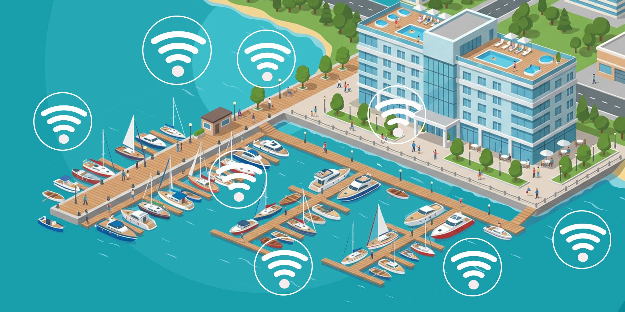
Smart Marina Management
Real-time visibility into marina assets, utilities, and security. Monitor, manage, and monetize marina resources more efficiently.
Real-time visibility into marina assets, utilities, and security. Monitor, manage, and monetize marina resources more efficiently.
Smarter Technologies
Smarter Technologies
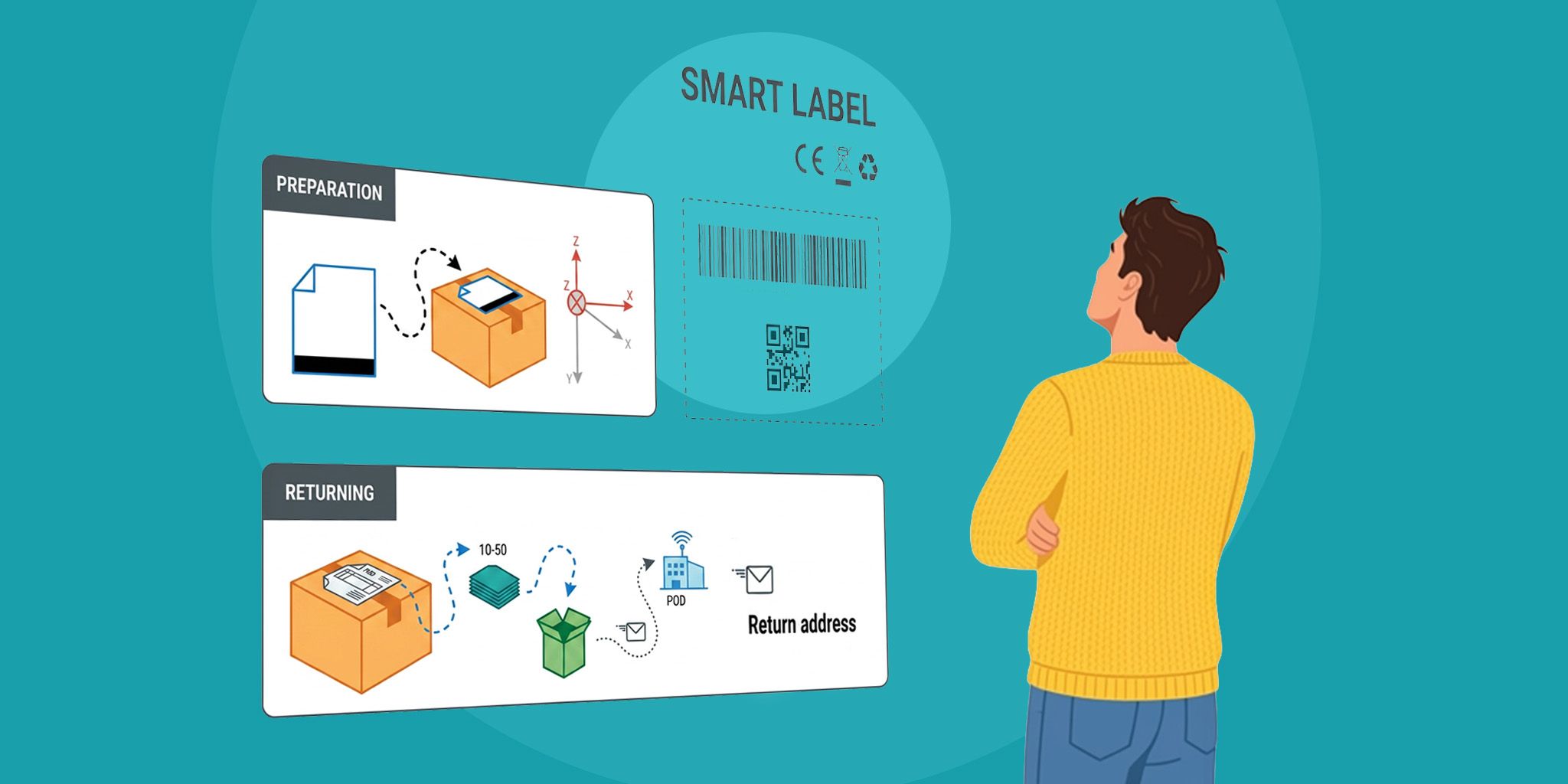
Smart Shipping Label for Supply Chain
Easy-to-deploy shipping label that provides real-time visibility into location, condition, and handling to reduce damage and optimize logistics.
Easy-to-deploy shipping label that provides real-time visibility into location, condition, and handling to reduce damage and optimize logistics.
SODAQ
SODAQ
Asset Tracking for Military Bases
Track military equipment, vehicles, personnel, and more to improve accountability, logistics, and operational readiness.
Track military equipment, vehicles, personnel, and more to improve accountability, logistics, and operational readiness.
Smarter Technologies
Smarter Technologies
Related Solutions
Maritime & Boating
Smart Marina Management
Real-time visibility into marina assets, utilities, and security. Monitor, manage, and monetize marina resources more efficiently.
Smarter Technologies
Supply Chain & Logistics
Smart Shipping Label for Supply Chain
Easy-to-deploy shipping label that provides real-time visibility into location, condition, and handling to reduce damage and optimize logistics.
SODAQ
Buildings & Facilities
Asset Tracking for Military Bases
Track military equipment, vehicles, personnel, and more to improve accountability, logistics, and operational readiness.
Smarter Technologies